Alberta Weather, climate and geography
Geography
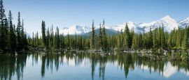
Alberta is the most westerly of the 'prairie and plains' provinces, bordered to the west by British Columbia and the Rockies, and to the south by Montana. In the north, along the border with the Northwest Territories, there is a wilderness of forests, lakes and rivers. Mt Columbia on the western Rocky Mountains border is the highest point, rising to 3,747m (12,293ft). Alberta also has significant icefields. They release meltwaters which supply the Mackenzie River flowing into the Arctic Ocean, and the North Saskatchewan River flowing into Hudson Bay.
Do you have any Feedback about this page?
© 2026 Columbus Travel Media Ltd. All rights reserved. No part of this site may be reproduced without our written permission, click here for information on Columbus Content Solutions.


 You know where