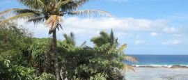
Tonga Weather, climate and geography
Geography
Tonga is an archipelago of 176 islands in the South Pacific - most of which are uninhabited - covering an area of 7,700 sq km (3,000 sq miles). The major island groups are 'Eua, Ha'apai, the Niuas, Tongatapu and Vava'u. Tonga's high volcanic and low coral forms give the islands a unique character. Some volcanoes are still active and Falcon Island in the Vava'u group is a submerged volcano that erupts periodically, its lava and ash rising above sea level forming a visible island which disappears when the eruption is over.
Nuku'alofa, on Tongatapu Island, has a reef-protected harbour lined with palms. The island is flat with a large lagoon, but no running streams, and many surrounding smaller islands. 'Eua Island is hilly and forested with high cliffs and beautiful beaches. The Ha'apai Islands, a curving archipelago 160km (100 miles) north of Tongatapu, have excellent beaches. Tofua, the largest island in the group, is an active volcano with a hot steaming lake in its crater. The Vava'u Islands, 90km (50 miles) north of Ha'apai, are hilly, densely wooded and interspersed with a maze of narrow channels. They are known for their stalagmite-filled caves.
Do you have any Feedback about this page?
© 2026 Columbus Travel Media Ltd. All rights reserved. No part of this site may be reproduced without our written permission, click here for information on Columbus Content Solutions.


 You know where